UK Area: Other...
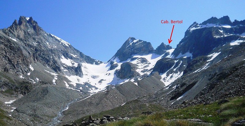
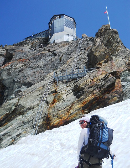
Details: Haute Route: Cabane des Vignettes to Cabane Bertol via Col de l'Eveque
Distance: 18km – Duration: 8hrs – Ascent: 1,170m – Descent: 1,000m
Weblink: http://www.haroldstreet.org.uk/other/glacier-fest-swiss-alpine-trip-june-2015/
Author: Phil Newby Type: route/track
The content of Members pages including their GPS files are copyright to the contributing Member
Any waypoints maked in Blue are included in the GPS file download.
The green icon marks the start point of the GPX Track or Route.
Other icons are not included in this file and only indicate nearby Hills & Trigpoints
Bagging 'Haute Route: Cabane des Vignettes to Cabane Bertol' Route:
Walked this route? Log in to rate it, and tick it as completed...
Member's Comments on 'Haute Route: Cabane des Vignettes to Cabane Bertol' Route/Track...
- Phil Newby says...
- Phil Newby says...
- Register... and Log In...