UK Area: Wales
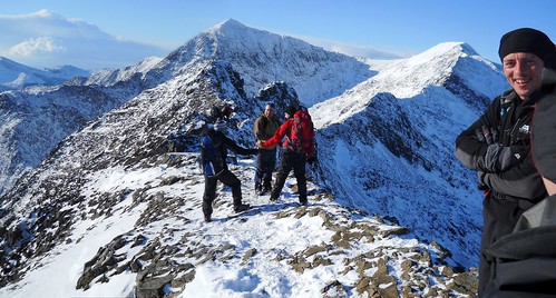
Details: Crib Goch, Crib y Ddysgl, Yr Wyddfa (aka Snowdon), Y Lliwedd
NB: This file is a 'GPS Track' recorded by a GPS in the field.
Start: Pen-y-pass
Distance: 6.8 miles, Ascent: 1041 meters - View Ascent Profile..., Estimated Walking Time: 5 hrs.
Author: Phil Newby Type: route/track
The content of Members pages including their GPS files are copyright to the contributing Member
Any waypoints maked in Blue are included in the GPS file download.
The green icon marks the start point of the GPX Track or Route.
Other icons are not included in this file and only indicate nearby Hills & Trigpoints
Hills near Snowdon Horseshoe route:
Moel Berfedd (482m) Clogwyn Pen Llechen (421m) Snowdon-Yr Wyddfa (1085m) Crib y Ddysgl (1065m) Crib Goch (924m) Y Lliwedd (898m) Y Lliwedd East Top (893m) Lliwedd Bach (819m) Craig Fach (609m) Yr Wyddfa East top (808m) Y Lliwedd West Top (760m) Snowdon Pen-y-Pass YHA (0m) Crib Goch Lower Pinnacle (902m) Crib Goch East Top (921m) Lliwedd Bach NE Top (694m) Craig Fach East Top (563m) Carreg Gwalch (546m) Pen Llyn Teyrn (479m)
Bagging 'Snowdon Horseshoe ' Route:
Walked this route? Log in to rate it, and tick it as completed...
adoling Barry432 (4*) bigalga1 bradders1999 (5*) DanHolme (4*) Darren Morgan (5*) dazzle482000 delterry (5*) Fazsim (5*) Glyn Griffiths (5*) JGIBSON (4*) jzimmy12345 KJB (5*) Knoutberry (4*) Lance (4*) MarkCarr203 McEbets Michael (5*) midgebait (4*) Mossylea (4*) nordicstar (5*) Ozymandias30 (5*) Phil Newby (5*) Phil Newby (2nd) (5*) rhayader_wanderer (5*) Ronnie Bowron (5*) Sleepwalker (3*) Squirrelly Nutcase (5*) theglade (3*) thenomad (2*) thetills
Member's Comments on 'Snowdon Horseshoe ' Route/Track...
- Phil Newby (2nd) says...
- Wonderful done in winter conditions
- Glyn Griffiths says...
- Phil your a very fit man, for us lesser humans 5hrs is a bit optimistic. It took me 6.44 hrs. Also my GPS says i did 8.7 miles compared to your 6.8 miles Any way please don't be offended by my comments, the route was fantastic almost epic for me. Im just passing the time and updating my Hill Bagging.
- Register... and Log In...