Database of British and Irish Hills (DoBIH) v 18.5
We have upgraded to version 18.5 of the Database of British and Irish hills. See here for detailed changes… www.hill-bagging.co.uk/dobih/downloads
We have upgraded to version 18.5 of the Database of British and Irish hills. See here for detailed changes… www.hill-bagging.co.uk/dobih/downloads
Haroldstreet now hosts the Irish Trigpoints… https://www.haroldstreet.org.uk/trigpoints/trig-bagging.php?area=ireland Thanks to Graeme Paterson, Martin Richardson and Rob Woodall for helping make this happen.
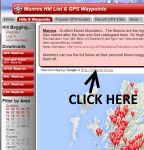
A few weeks ago we lost our Ordnance Survey Mapping, but today we’ve found another way of implementing the code and got it back! Above each map you will now see the following links… Enjoy…
With the latest data from DoBIH www.haroldstreet.org.uk now hosts GPX files & Bagging list for the Significant Islands of Britain (SIBs) SIBs are defined as naturally occuring land which at MHWS is completely surrounded by water with either an area of at least 10 hectares within the MHWS contour line or a prominence of at » read more »
We now host GPS Waypoints and a bagging list for the Hardys. www.haroldstreet.org.uk/waypoints/download/?list=hardys Based on The Hardys; The UKs High Points, by Ian Hardy, first published 1997 see www.thehardys.org Cheers phil
Author: Phil Newby