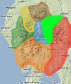
Area: EASTERN FELLS -
TumpBeags - hills in Britain & Ireland with 15m-19.9m prominence irrespective of height.
The list has been compiled by Bernie Hughes, and includes data originated by Myrddyn Phillips and Aled Williams. Source lists available at
The Welsh P15s, The Fours and The Welsh Highlands - Uchafion Cymru. Thanks also to
https://MountainViews.ie/ for permssion to include data from their Arderin Begs list.
Members can use the list below as their personal TumpBeag bagging tick list. Just register and log in to tick them off...
TumpBeag List & GPS Waypoints:
Climbed any of these hills? Log in to tick them off...
Sort this list by: Name | Height | Popularity | Prominence | Significance
- '0320.-' NY428217 Birk Crag NW Top (320m, p17.7)
- '0305.-' NY408265 Brownhow Hill (305m, p16)
- '0552.b' NY382204 Common Fell (552m, p18)
- '0464.s' NY407213 Gowbarrow Park (464m, p18)
- '0293.-' NY458276 Hall Bank (293m, p18.4)
- '0925.N' NY337155 Helvellyn Lower Man (925m, p18.4)
- '0404.b' NY422227 Little Meldrum (404m, p19)
- '0497.b' NY374215 Low How (497m, p18)
- '0508.w' NY373078 Low Pike (508m, p18)
- '0541.s' NY364222 Matterdale Common (541m, p17)
- '0474.s' NY381113 Stangs (474m, p17)
- '0295.-' NY414264 Stoddah Bank (295m, p15.3)
- '0553.b' NY379197 Swineside Knott (553m, p15)
- '0514.b' NY330230 Threlkeld Knotts (514m, p18)
- '0141.-' NY345065 White Moss Common SW Top (141m, p16.4)
Total = 15 TumpBeags in OS Area EASTERN FELLS