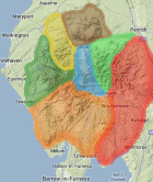
Area: FAR EASTERN FELLS -
Sub-Marsh - 133 summits which are over 600 metres but fail the 30 metre drop from the four books by Terry Marsh: The Mountains of Wales (1985), The Lakes Mountains Vol 1 and 2 (1987) and The Pennine Mountains (1989) all published by Hodder & Stoughton. The list was defined by the original publication and is not subject to revision.
Members can use the list below as their personal Sub-Marsh bagging tick list. Just register and log in to tick them off...
Sub-Marsh List & GPS Waypoints:
Climbed any of these hills? Log in to tick them off...
Sort this list by: Name | Height | Popularity | Prominence | Significance
- '0666.b' NY471090 Adam Seat (666m, p9)
- '0673.n' NY487103 Branstree NE Top (Branstree East Top) (High Howes (Mardale)) (673m, p24)
- '0755.b' NY412100 Caudale Moor-John Bell’s Banner (755m, p10)
- '0637.n' NY500077 Harrop Pike (637m, p15)
- '0754.b' NY456137 Low Raise (754m, p5)
- '0711.b' NY450151 Red Crag (711m, p11)
Total = 6 Sub-Marsh in OS Area FAR EASTERN FELLS