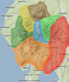
Area: SOUTHERN FELLS -
BEFours - The 400m Hills of Britain and Éire (Britain & Éire Fours) comprises all Scottish, English, Manx, Welsh and Irish hills 400m or more and below 500m in height with 30m or more in prominence.
List compiled from data originated by E D 'Clem' Clements, Myrddyn Phillips and Aled Williams. Source lists available on Haroldstreet, MappingMountains and DoBIH, by Myrddyn Phillips and Aled Williams
Members can use the list below as their personal BEFour bagging tick list. Just register and log in to tick them off...
jackdee98's BEFours:
Climbed any of these hills? Log in to tick them off...
Sort this list by: Name | Height | Popularity | Prominence | Significance
- '0444.b' SD204974 Birker Fell-White How (444m, p30.9)
- '0469.b' SD200987 Crook Crag (469m, p54)
- '0408.b' NY302021 Great Intake-Low Fell (408m, p47)
- '0427.b' SD194968 Great Worm Crag (427m, p34)
- '0489.w' SD200982 Green Crag (489m, p142)
- '0478.b' SD176946 Hesk Fell (478m, p98.7)
- '0411.s' SD249942 Lag Bank (Broughton Moor) (411m, p30.3)
- '0470.W' NY302046 Lingmoor Fell (Brown How) (470m, p247)
- '0416.s' NY302052 Oakhowe Crag (416m, p30)
- '0469.b' SD237947 Pikes (469m, p43)
- '0404.b' NY227043 Throstlehow Crag (404m, p38)
- '0499.b' NY231030 Yew Bank (499m, p31)
- '0494.b' SD156952 Yoadcastle (494m, p58)
All these waypoints have been bagged by...
alan caine amalia amblerbob Chris Pearson chrisd101 Dangerous Dave dave geere David Gradwell edgradwell gerrybowes iwc Jim.Fothergill jonglew Liz_N Martin R Matt murphy Mhr1952 moorsman Nettle Graves ngthack nordicstar Peebs rhw Ronnie Bowron snaithd Tim Nicholl Tommy Wanderer willbarton100 Wycombe Wanderer
Total = 13 BEFours in OS Area SOUTHERN FELLS