Area: EASTERN FELLS -
Sub-TuMPs - SubTumps - hills in Britain & Ireland with 20m-29.9m prominence irrespective of height. The list has been compiled by Bernie Hughes, and includes data originated by Myrddyn Phillips and Aled Williams. Source lists available at The Fours. Thanks also to https://MountainViews.ie/ for permission to include data from their lists.
Members can use the list below as their personal Sub-TuMP bagging tick list. Just register and log in to tick them off...
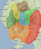
Selected mapping: Google or Bing / Ordnance Survey
Map Legend: :Sub-TuMPs | :Nearby Sub-TuMPs
Sub-TuMP List & GPS Waypoints:
Climbed any of these hills? Log in to tick them off...
Sort this list by: Name | Height | Popularity | Prominence | Significance
- '0586.w' NY383120 Hartsop Above How (Gill Crag-Hartsop Above How) (586m, p29.5)
- '0891.N' NY343142 Nethermost Pike (891m, p29.1)
- '0339.b' NY321196 Castle Rock (339m, p29)
- '0794.N' NY352187 Green Side (White Stones-Green Side) (794m, p28.9)
- '0243.-' NY315170 Station Coppice (243m, p28)
- '0143.-' NY346066 White Moss Common (143m, p27.2)
- '0280.-' NY464285 Flusco Pike (280m, p26.3)
- '0387.b' NY391208 Round How (387m, p26)
- '0176.-' NY481263 Barton Hill (176m, p24.8)
- '0575.b' NY367214 High Brow (575m, p24)
- '0756.N' NY359197 Hart Side (756m, p23)
- '0621.N' NY357086 Heron Pike North Top (Rydal Fell) (621m, p22.4)
- '0718.N' NY363159 Birkhouse Moor (718m, p22.3)
- '0444.-' NY390146 Trough Head Top (444m, p21.6)
- '0199.-' NY314157 Hawes How Island (199m, p21.1)
- '0373.b' NY392210 Bracken How (373m, p21)
- '0612.n' NY355083 Heron Pike (Rydal) (612m, p21)
- '0287.-' NY437239 Bennethead (287m, p20.5)
- '0624.N' NY380143 Birks (624m, p20.3)
Total = 19 Sub-TuMPs in OS Area EASTERN FELLS