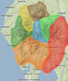
Area: EASTERN FELLS -
Synges - Synge's Lakeland Summits - Hills from the book 'The Lakeland Summits' by Tim Synge: covers the whole of the Lake District national park.
Members can use the list below as their personal Synge bagging tick list. Just register and log in to tick them off...
Synge data courtesy of Nick Wakelam and Michael Earnshaw
Selected mapping: Google or Bing / Ordnance Survey
Map Legend: :Synges | :Nearby Synges
Synge List & GPS Waypoints:
Climbed any of these hills? Log in to tick them off...
Sort this list by: Name | Height | Popularity | Prominence | Significance
- '0950.H' NY342151 Helvellyn (950m, p713)
- '0873.H' NY358117 Fairfield (873m, p300)
- '0776.H' NY396087 Red Screes (776m, p260)
- '0841.H' NY369133 St Sunday Crag (841m, p160)
- '0505.W' NY423240 Little Mell Fell (505m, p226)
- '0737.H' NY344115 Seat Sandal (737m, p151)
- '0537.W' NY396253 Great Mell Fell (537m, p198)
- '0857.H' NY342205 Great Dodd (857m, p109)
- '0883.H' NY342174 Raise (883m, p91.6)
- '0726.H' NY333225 Clough Head (726m, p108)
- '0676.H' NY369181 Sheffield Pike (676m, p93)
- '0844.H' NY343189 Stybarrow Dodd (844m, p68.9)
- '0890.H' NY348158 Catstye Cam (890m, p62.4)
- '0333.b' NY313187 Great How (Thirlmere) (333m, p140)
- '0859.H' NY346130 Dollywaggon Pike (859m, p50.3)
- '0823.H' NY368112 Hart Crag (823m, p51.2)
- '0792.H' NY374104 Dove Crag (792m, p50)
- '0863.H' NY337166 White Side (863m, p43.1)
- '0863.h' NY350149 Striding Edge (High Spying How) (863m, p31.2)
- '0891.N' NY343142 Nethermost Pike (891m, p29.1)
- '0766.H' NY355104 Great Rigg (766m, p31)
- '0794.N' NY352187 Green Side (White Stones-Green Side) (794m, p28.9)
- '0637.H' NY387100 Little Hart Crag (Little Hart Crag-West Top) (637m, p34)
- '0442.w' NY380175 Glenridding Dodd (442m, p45)
- '0437.b' NY414223 Great Meldrum (437m, p41)
- '0756.N' NY359197 Hart Side (756m, p23)
- '0455.s' NY381225 Cockley Moor (455m, p38)
- '0586.w' NY383120 Hartsop Above How (Gill Crag-Hartsop Above How) (586m, p29.5)
- '0925.N' NY337155 Helvellyn Lower Man (925m, p18.4)
- '0424.b' NY424233 Watermillock Fell (Little Mell Fell South Top) (424m, p40)
- '0718.N' NY363159 Birkhouse Moor (718m, p22.3)
- '0621.N' NY357086 Heron Pike North Top (Rydal Fell) (621m, p22.4)
- '0433.w' NY393149 Arnison Crag (433m, p32)
- '0575.b' NY367214 High Brow (575m, p24)
- '0612.n' NY355083 Heron Pike (Rydal) (612m, p21)
- '0624.N' NY380143 Birks (624m, p20.3)
- '0302.s' NY451275 Dacre Bank (302m, p40)
- '0342.s' NY428219 Hagg Hill (Hagg Wood) (342m, p34)
- '0311.s' NY385162 Keldas (311m, p35)
- '0823.b' NY358120 Cofa Pike (823m, p13)
- '0387.b' NY391208 Round How (387m, p26)
- '0552.b' NY382204 Common Fell (552m, p18)
- '0339.b' NY321196 Castle Rock (339m, p29)
- '0514.b' NY330230 Threlkeld Knotts (514m, p18)
- '0541.s' NY364222 Matterdale Common (541m, p17)
- '0654.w' NY397095 Middle Dodd (654m, p14)
- '0508.w' NY373078 Low Pike (508m, p18)
- '0497.b' NY374215 Low How (497m, p18)
- '0789.w' NY335195 Watson’s Dodd (789m, p11)
- '0464.s' NY407213 Gowbarrow Park (464m, p18)
- '0553.b' NY379197 Swineside Knott (553m, p15)
- '0474.s' NY381113 Stangs (474m, p17)
- '0373.b' NY392210 Bracken How (373m, p21)
- '0884.b' NY343136 High Crag (Grisedale) (884m, p8.7)
- '0404.b' NY422227 Little Meldrum (404m, p19)
- '0512.b' NY392124 Gale Crag (512m, p13)
- '0729.b' NY348210 Randerside (729m, p9)
- '0610.b' NY327176 Brown Crag (610m, p10)
- '0551.b' NY377194 Brown Hills (551m, p11)
- '0660.b' NY330211 Calfhow Pike (660m, p9)
- '0612.b' NY373178 Heron Pike (Glenridding) (612m, p9)
- '0305.s' NY408265 Brownhow Hill (305m, p16)
- '0481.w' NY407218 Gowbarrow Fell (Wainwright summit) (481m, p9)
- '0656.w' NY374088 High Pike (Scandale) (656m, p6)
- '0644.s' NY390075 Snarker Pike (644m, p6)
- '0542.s' NY379202 Watermillock Common (542m, p7)
- '0627.s' NY339229 White Pike (627m, p6)
- '0319.s' NY429217 Birk Crag (319m, p10)
- '0784.b' NY372134 Gavel Pike (784m, p4)
- '0859.s' NY332156 Browncove Crags (859m, p3)
- '0332.s' NY319162 The Swirls (332m, p7)
- '0519.w' NY393107 High Hartsop Dodd (519m, p3)
- '0504.w' NY347092 Stone Arthur (504m, p3)
- '0673.s' NY353175 Stang (673m, p2)
- '0450.w' NY355072 Nab Scar (450m, p2)
- '0754.s' NY394085 Raven Crag (754m)
All these waypoints have been bagged by...
amblerbob bailer01 Chris Jackson Chris Pearson dave geere iwc jonglew Liz_N Mhr1952 moorsman nordicstar Peebs rhw Ronnie Bowron snaithd Wycombe Wanderer
Total = 76 Synges in OS Area EASTERN FELLS
Synge data courtesy of Nick Wakelam and Michael Earnshaw