Area: NORTH WESTERN FELLS -
Synges - Synge's Lakeland Summits - Hills from the book 'The Lakeland Summits' by Tim Synge: covers the whole of the Lake District national park.
Members can use the list below as their personal Synge bagging tick list. Just register and log in to tick them off...
Synge data courtesy of Nick Wakelam and Michael Earnshaw
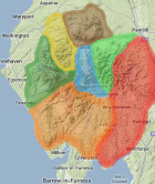
Selected mapping: Google or Bing / Ordnance Survey
Map Legend: :Synges | :Nearby Synges
Synge List & GPS Waypoints:
Climbed any of these hills? Log in to tick them off...
Sort this list by: Name | Height | Popularity | Prominence | Significance
- '0852.H' NY174203 Grasmoor (852m, p518)
- '0753.H' NY222153 Dale Head (753m, p397)
- '0791.H' NY198225 Grisedale Pike (791m, p189)
- '0552.W' NY204265 Lord’s Seat (552m, p237)
- '0737.H' NY201168 Robinson (737m, p161)
- '0839.H' NY192203 Crag Hill (Eel Crag) (839m, p116)
- '0653.H' NY234162 High Spy (653m, p147)
- '0770.H' NY185221 Hopegill Head (770m, p97.2)
- '0581.w' NY206197 Ard Crags (581m, p116)
- '0727.H' NY215165 Hindscarth (727m, p71)
- '0359.w' NY194296 Sale Fell (359m, p137)
- '0568.w' NY211214 Outerside (568m, p74)
- '0451.w' NY244198 Cat Bells (Catbells) (451m, p87)
- '0672.H' NY208206 Scar Crags (672m, p55)
- '0374.w' NY179285 Ling Fell (374m, p98)
- '0455.b' NY177264 Graystones (455m, p77)
- '0455.w' NY227218 Barrow (455m, p71)
- '0525.b' NY196249 Whinlatter Top (525m, p58)
- '0556.w' NY197188 Knott Rigg (556m, p53)
- '0719.H' NY175221 Whiteside East Top (Whiteside) (Gasgale Crags) (719m, p39.3)
- '0738.H' NY193220 Hobcarton Crag (Hobcarton Head) (738m, p35.9)
- '0637.H' NY218208 Causey Pike (637m, p40)
- '0773.H' NY198202 Sail (773m, p32)
- '0660.H' NY180189 Whiteless Pike (660m, p36.2)
- '0526.b' NY186168 High Snockrigg (526m, p45)
- '0774.H' NY188197 Wandope (774m, p30.5)
- '0355.w' NY167182 Rannerdale Knotts (355m, p66)
- '0290.w' NY249159 Castle Crag (290m, p75)
- '0704.N' NY184227 Ladyside Pike (704m, p29.2)
- '0525.b' NY209260 Ullister Hill (525m, p34)
- '0469.w' NY214267 Barf (469m, p38)
- '0454.b' NY169230 Dodd (Lorton) (454m, p39)
- '0447.b' NY220219 Stile End (447m, p35)
- '0510.w' NY195270 Broom Fell (510m, p28.9)
- '0756.n' NY187218 Sand Hill (756m, p17)
- '0707.n' NY170219 Whiteside (Whiteside West Top) (707m, p18)
- '0493.b' NY206253 Tarbarrel Moss (493m, p24)
- '0634.n' NY236171 High Spy North Top (634m, p16)
- '0345.b' NY203296 Lothwaite (345m, p27)
- '0634.b' NY195234 Hobcarton End (634m, p14.1)
- '0546.b' NY199191 Ill Crag (Newlands) (Knott Rigg North Top) (546m, p16)
- '0440.s' NY213179 High Snab Bank (440m, p19)
- '0517.w' NY191251 Whinlatter (Brown How-Whinlatter) (517m, p16)
- '0437.b' NY172265 Kirk Fell (Lorton) (437m, p14.8)
- '0374.b' NY219232 Kinn (374m, p17)
- '0529.b' NY217174 High Crags (Newlands) (529m, p11)
- '0575.w' NY236181 Maiden Moor (575m, p10)
- '0335.b' NY197294 Rivings (335m, p15)
- '0318.b' NY188283 Burthwaite Heights (318m, p15)
- '0338.b' NY244205 Skelgill Bank (338m, p14)
- '0556.s' NY233149 High Scawdel (556m, p7)
- '0475.s' NY195213 Force Crag (475m, p8)
- '0319.s' NY167274 Embleton High Common (319m, p11)
- '0412.s' NY236190 High Crags (412m, p8)
- '0495.b' NY213256 Seat How (Thornthwaite) (495m, p6)
- '0404.s' NY182269 Widow Hause (404m, p7)
- '0433.b' NY229206 Rowling End (433m, p6)
- '0521.s' NY242161 Low Scawdel (521m, p4)
- '0412.b' NY224183 Scope End (412m, p5)
- '0426.b' NY171192 Lad Hows (426m, p4)
- '0420.s' NY243168 Nitting Haws (420m, p4)
- '0413.s' NY165212 Whin Ben (413m, p4)
- '0473.s' NY215199 Aikin Knott (473m, p1)
All these waypoints have been bagged by...
amblerbob bailer01 Chris Pearson chrisd101 dave geere David iwc jackmignall@hotmail. jonglew Liz_N Mhr1952 moorsman nordicstar owaincaesarius Peebs rhw Ronnie Bowron snaithd TarnHows Wycombe Wanderer
Total = 63 Synges in OS Area NORTH WESTERN FELLS
Synge data courtesy of Nick Wakelam and Michael Earnshaw