lakes-
Fours - A 'Four' is a hill in England between the heights of 400 metres and 499 metres with a minimum drop of 30 metres. There are 296 such hills that cover the length of the country from the Cheviot Hills in the north, to Bodmin Moor in the south-west.
Further details at Mapping Mountains Publications
Members can use the list below as their personal Four bagging tick list. Just register and log in to tick them off...
Data courtesy of Myrddyn Phillips and Aled Williams
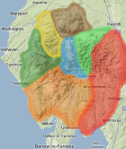
Selected mapping: Google or Bing / Ordnance Survey
Map Legend: :Fours
Four List & GPS Waypoints:
Climbed any of these hills? Log in to tick them off...
Sort this list by: Name | Height | Popularity | Prominence | Significance
- '0469.W' NY302046* Lingmoor Fell (470m, p248.3)
- '0423.W' NY137226* Low Fell (423m, p266)
- '0447.W' NY225355 Binsey (447m, p242)
- '0494.P' SD598998 Grayrigg Forest (494m, p188)
- '0487.w' NY403051* Baystones (487m, p147.7)
- '0489.w' SD200982* Green Crag (489m, p144)
- '0447.b' NY094190* Murton Fell (446m, p139)
- '0429.s' NY487015* Sleddale Forest (429m, p116)
- '0481.p' NY407217* Gowbarrow Fell (481m, p100.1)
- '0477.b' SD176946* Hesk Fell (477m, p99)
- '0482.-' NY565022 Mabbin Crag (482m, p97)
- '0419.s' NY268171* Ether Knot (420m, p97.5)
- '0495.b' NY543048* High House Bank (496m, p80.2)
- '0451.w' NY244198* Catbells (452m, p87.5)
- '0485.-' NY558045* Pt. 484.4m (484m, p80.2)
- '0472.-' NY573002* Whinfell Beacon (472m, p78)
- '0456.b' NY177264* Graystones (456m, p78)
- '0490.b' NY542061* Whatshaw Common (489m, p70)
- '0478.-' NY569014* Castle Fell (478m, p70)
- '0426.b' NY469040* Hollow Moor (425m, p77)
- '0455.w' NY227218* Barrow (455m, p71)
- '0405.w' NY326093* Helm Crag (404m, p71.1)
- '0494.b' SD156952* Yoadcastle (494m, p57)
- '0469.b' SD200987* The Pike (469m, p54)
- '0432.w' NY440181* Steel Knots (432m, p52.7)
- '0446.b' NY302193* The Benn (445m, p50.3)
- '0416.w' NY132242 Fellbarrow (416m, p51.6)
- '0461.w' NY303187* Raven Crag (460m, p43)
- '0442.w' NY380175* Glenridding Dodd (443m, p44.6)
- '0469.b' SD237947* Pikes (469m, p42)
- '0408.b' NY302021* Hull Howe (407m, p47)
- '0471.-' NY570037* Whinash (470m, p40.3)
- '0452.s' NY557085* Long Fell (451m, p42)
- '0471.-' NY562027* Ashstead Fell (471m, p40)
- '0437.b' NY414223* Great Meldrum (438m, p41.2)
- '0483.w' NY275353* Longlands Fell (483m, p37)
- '0454.b' NY169230* Dodd (454m, p39)
- '0469.w' NY214267* Barf (469m, p37.7)
- '0416.w' NY264162* Brund Fell (417m, p42.3)
- '0488.w' NY084140* Grike (487m, p35.8)
- '0456.b' NY116173* Banna Fell (455m, p38)
- '0489.b' NY487164* Pt. 489m (489m, p35)
- '0483.w' NY427032* Sour Howes (483m, p35)
- '0455.s' NY381225* Cockley Moor (455m, p37)
- '0424.b' NY424233* Pt. 424m (424m, p39)
- '0400.s' NY266143* Knots (402m, p40.1)
- '0493.b' NY515052* Long Crag (493m, p32)
- '0447.b' NY220219* Stile End (447m, p35)
- '0499.b' NY231030* Yew Bank (499m, p31)
- '0404.b' NY227043* Throstlehowe Crag (404m, p38)
- '0493.b' NY530058* Robin Hood (492m, p30.1)
- '0449.w' NY270146* Great Crag (448m, p32.9)
- '0427.b' SD193968* Great Worm Crag (427m, p34)
- '0482.b' NY394041* Wansfell Pike (484m, p30)
- '0411.b' NY134233* Sourfoot Fell (411m, p34)
- '0433.w' NY393149* Arnison Crag (434m, p32)
- '0444.b' SD204974* White Howe (444m, p30.9)
- '0417.-' NY302052* Oakhowe Crag (416m, p30.4)
- '0412.s' SD250943* Lag Bank (411m, p30)
All these waypoints have been bagged by...
alan caine amblerbob Chris Pearson chrisd101 dave geere iwc jonglew moorsman nordicstar oakesave Peebs rhw Ronnie Bowron snaithd Wycombe Wanderer
Total = 59 Fours in Lake District
Data courtesy of Myrddyn Phillips and Aled Williams