Area: NORTH WESTERN FELLS -
TumpBeags - hills in Britain & Ireland with 15m-19.9m prominence irrespective of height.
The list has been compiled by Bernie Hughes, and includes data originated by Myrddyn Phillips and Aled Williams. Source lists available at
The Welsh P15s, The Fours and The Welsh Highlands - Uchafion Cymru. Thanks also to
https://MountainViews.ie/ for permssion to include data from their Arderin Begs list.
Members can use the list below as their personal TumpBeag bagging tick list. Just register and log in to tick them off...
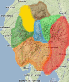
Selected mapping: Google or Bing / Ordnance Survey
Map Legend: :TumpBeags | :Nearby TumpBeags
TumpBeag List & GPS Waypoints:
Climbed any of these hills? Log in to tick them off...
Sort this list by: Name | Height | Popularity | Prominence | Significance
- '0318.b' NY188283 Burthwaite Heights (318m, p15)
- '0293.-' NY169280 Embleton High Common NE Top (293m, p17.4)
- '0440.s' NY213179 High Snab Bank (440m, p19)
- '0634.n' NY236171 High Spy North Top (634m, p16)
- '0546.b' NY199191 Ill Crag (Newlands) (Knott Rigg North Top) (546m, p16)
- '0374.b' NY219232 Kinn (374m, p17)
- '0315.-' NY175178 Low Bank (315m, p18)
- '0335.b' NY197294 Rivings (335m, p15)
- '0756.n' NY187218 Sand Hill (756m, p17)
- '0517.w' NY191251 Whinlatter (Brown How-Whinlatter) (517m, p16)
- '0707.n' NY170219 Whiteside (Whiteside West Top) (707m, p18)
Total = 11 TumpBeags in OS Area NORTH WESTERN FELLS