Area: WESTERN FELLS -
TumpBeags - hills in Britain & Ireland with 15m-19.9m prominence irrespective of height.
The list has been compiled by Bernie Hughes, and includes data originated by Myrddyn Phillips and Aled Williams. Source lists available at
The Welsh P15s, The Fours and The Welsh Highlands - Uchafion Cymru. Thanks also to
https://MountainViews.ie/ for permssion to include data from their Arderin Begs list.
Members can use the list below as their personal TumpBeag bagging tick list. Just register and log in to tick them off...
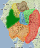
Selected mapping: Google or Bing / Ordnance Survey
Map Legend: :TumpBeags | :Nearby TumpBeags
TumpBeag List & GPS Waypoints:
Climbed any of these hills? Log in to tick them off...
Sort this list by: Name | Height | Popularity | Prominence | Significance
- '0330.b' NY115158 Brown How (Ennerdale) (330m, p17)
- '0499.s' NY143167 Gale Fell East Top (499m, p19.5)
- '0365.b' NY100182 Godworth (365m, p19)
- '0697.N' NY217125 Grey Knotts (697m, p16)
- '0475.b' NY109188 High Pen (475m, p18)
- '0311.b' NY094181 Kelton Fell (311m, p19)
- '0375.b' NY078116 Kinniside (375m, p16)
- '0733.n' NY140109 Little Gowder Crag (733m, p17)
- '0494.s' NY206132 Little Round How (494m, p16)
- '0628.n' NY186117 Looking Stead (Pillar) (628m, p18.9)
- '0780.n' NY171123 Pillar Rock (780m, p18.3)
- '0306.s' NY135254 Whin Fell (306m, p15)
All these waypoints have been bagged by...
bailer01 Chris Pearson chrisd101 dave geere edgradwell iwc jonglew Liz_N Margaret Mhr1952 moorsman nordicstar Peebs rhw Ronnie Bowron snaithd TarnHows Wycombe Wanderer
Total = 12 TumpBeags in OS Area WESTERN FELLS