Bernese Oberland Haute Route July 2017

For this year’s glacier trek we blatantly adapted KE Adventure’s Bernese Oberland Haute Route West and East trips.
Day 1:Les Diablerets to the Cabane Prarochet (2555m)
We took the Col du Pillon cable car to Sex Rouge (2945m) glacier plateau below the Les Diableret mountain ridge. We had planned to climb the peak but due to very thick fog we decided just to focus on navigating to the Cabane Prarochet instead.
Distance: 5.3km – Ascent: 50m – Descent: 450m
GPX Route: www.haroldstreet.org.uk/routes/download/?walk=2983
Accommodation: www.saviese.com/Site_alpha/decouverte_cabane_prarochet.htm

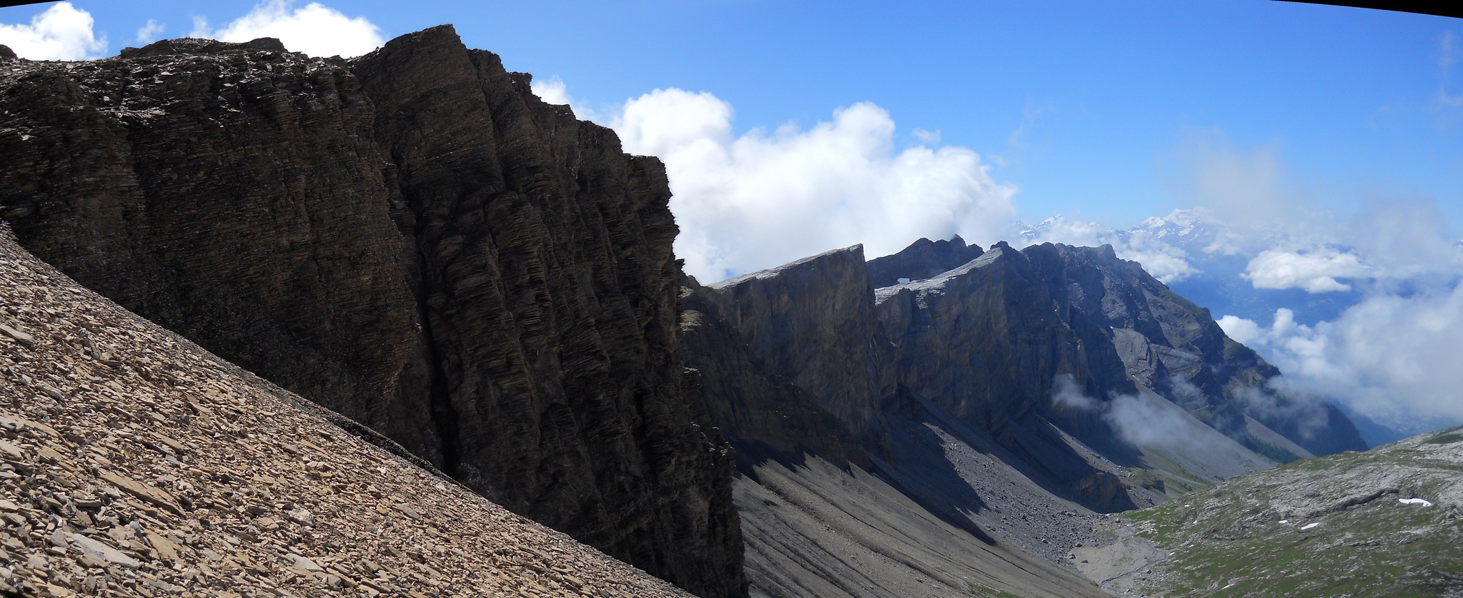
Cabane Prarochet (2555m)
Day 2: to the Cabane des Audannes (2508m).
We trekked across the Col du Sanetch (2252m) then on to Col des Audannes (2886m). Here we missed the Gelten Hut off our version of this trip.
Distance: 16km – Ascent: 930m – Descent: 935m
GPX Route: www.haroldstreet.org.uk/routes/download/?walk=2984
Accommodation: www.audannes.ch
Col des Audannes
Day 3: Climb the Wildhorn (3248m).
We got an early start and climbed the glaciated Wildhorn peak before returning to Cabane des Audannes for a second night.
Distance: 9km – Ascent: 850m – Descent: 850m
GPX Route: www.haroldstreet.org.uk/routes/download/?walk=2985
Accommodation: www.audannes.ch
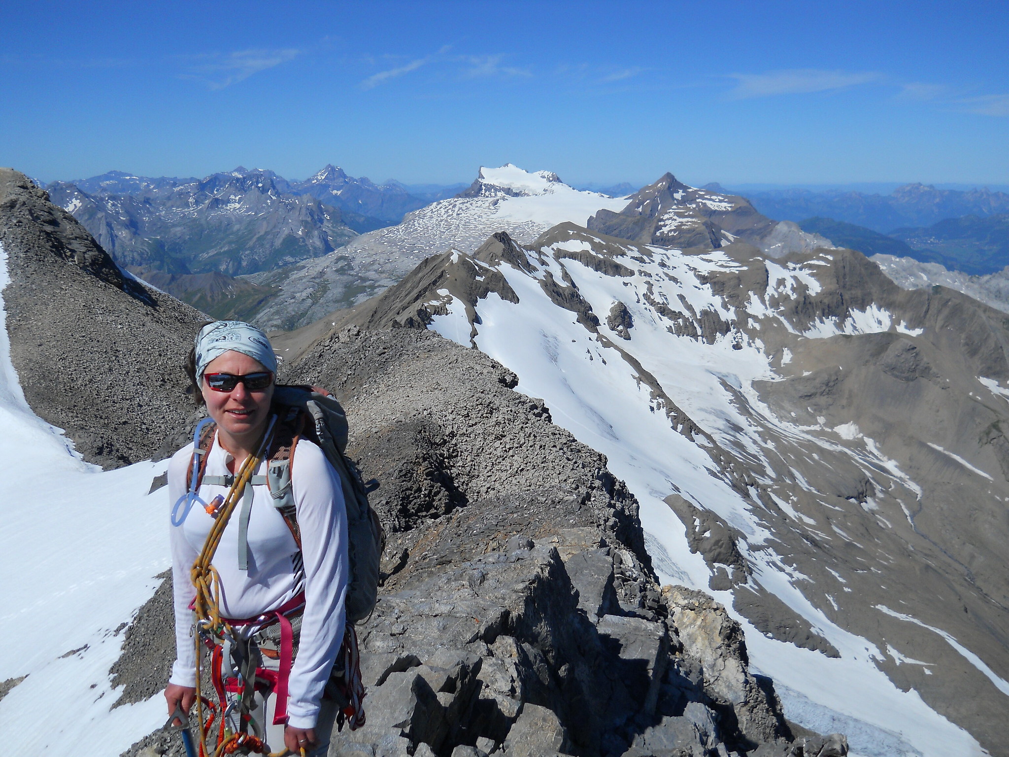
Wildhorn (3248m) summit looking towards Les Diablerets.
Day 4: to the Wildstrubel Hut (2791m).
We crossed Plan des Roses (2350m) and climbed up to the Wildstrubel Hut.
Distance: 12km – Ascent: 900m – Descent: 600m
GPX Route: www.haroldstreet.org.uk/routes/download/?walk=2986
Accommodation: www.wildstrubelhuette.ch

View from the Wildstrubel hut of the Wildhorn (3248m)
Day 5: to the Cabane Lammeren (2501m) via Wildstrubel (3243m)
Another early start over the Weisshorn Pass, and across the 4km Plaine Morte glacier. Then we climbed the Wildstrubel (3243m) and the Mittlerer Gipfel (3244m) before descending glaciers to Cabane Lammeren (2501m).
Distance: 15km – Ascent: 950m – Descent: 1010 m
GPX Route: www.haroldstreet.org.uk/routes/download/?walk=2987
Accommodation: www.laemmerenhuette.ch
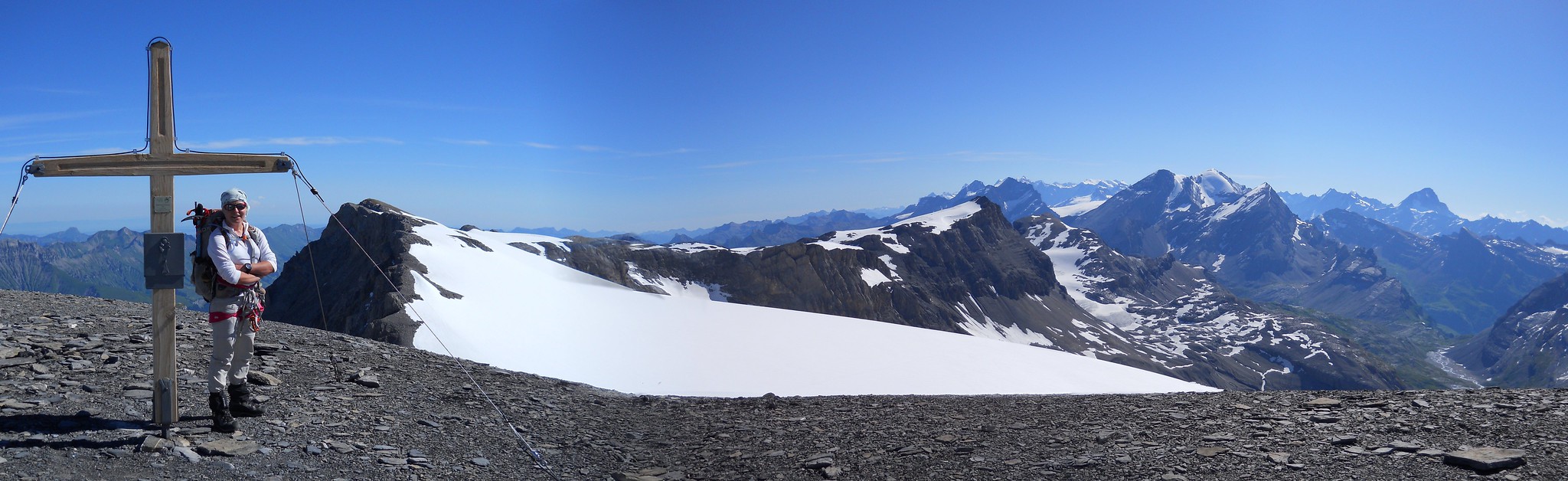
Wildstrubel (3243m) summit looking towards Mittlerer Gipfel (3244m)
Days 6 & 7: Weekend in Kandersteg
Finally, we crossed the Gemmi pass (2270m) to the Daubensee (2205m) and took a cable car down to Kandersteg for a weekend of luxury, laundry and pizza.
Distance: 17km – Ascent: 200m – Descent: 710m
GPX Route: www.haroldstreet.org.uk/routes/download/?walk=2988
Accommodation: www.hotel-restaurant-spycher.ch
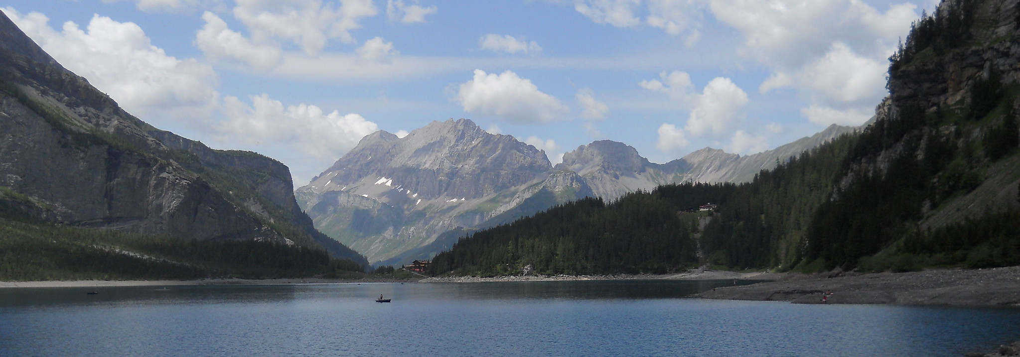
Rest day at Oeschinensee above Kandersteg
Day 8: to the Mutthorn Hut (2900m).
We took the local bus to Selden (1537m) and waited for the rain to stop. Then we walked up to the Kanderfirn Glacier and up to the Mutthorn Hut (2900m). We found we had the hut to ourselves due to the poor weather forecast.
Distance: 12km – Ascent: 1370m – Descent: 60m
GPX Route: www.haroldstreet.org.uk/routes/download/?walk=2989
Accommodation: www.mutthornhuette.ch
Mutthorn Hut (2900m).
Day 9: to the Anen Hut (2336m).
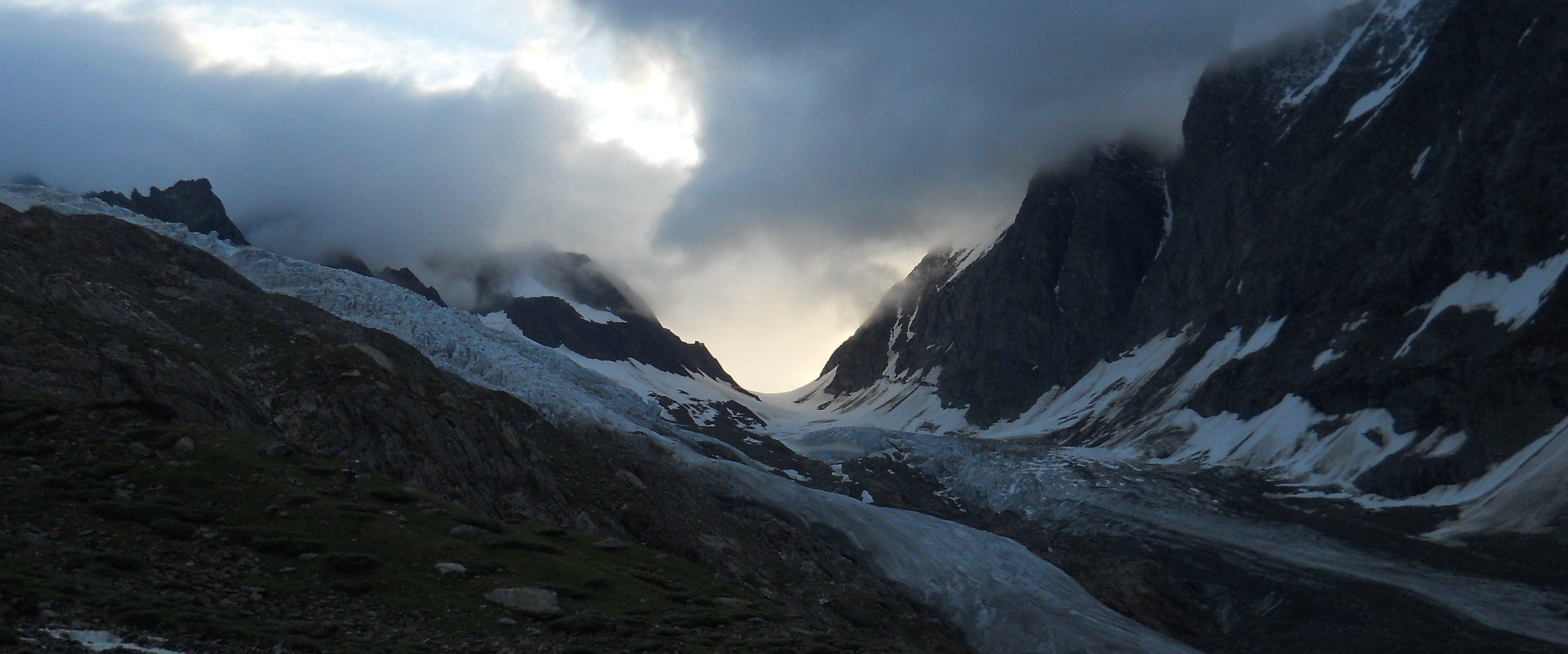
We carefully navigated across the Petersgrat (3205m) glacier in very thick fog and 50m visibility. then descended to Fafleralp (1787m). From there we walked up to the luxurious Anen Hut
Distance: 18km – Ascent: 870m – Descent: 1400m
GPX Route: www.haroldstreet.org.uk/routes/download/?walk=2990
Accommodation: http://anenhuette.ch
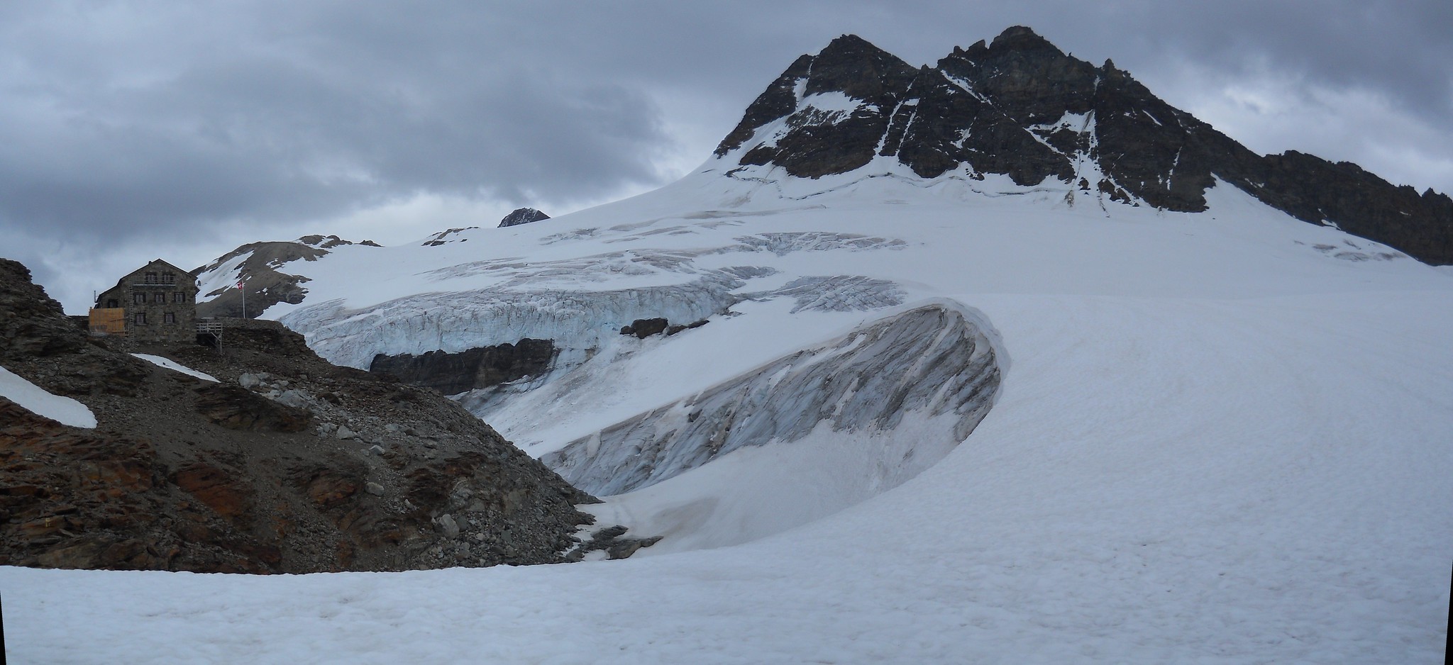
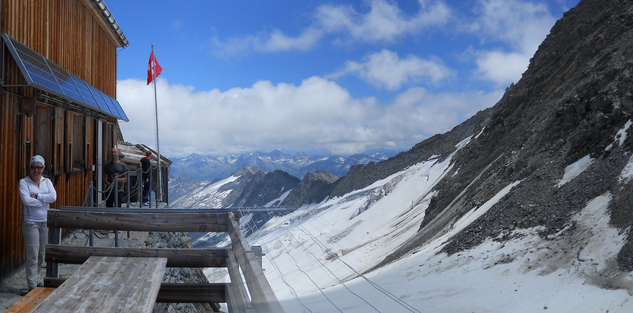
View from Anen Hut towards Hollandia Hut
Day 10: to the Hollandia Hut (3235m).
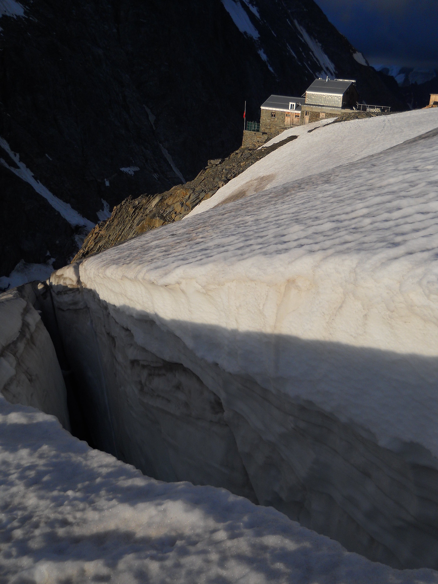
Hollandia Hut surrounded by crevasses.
Today involved a short walk up the glacier to the Hollandia Hut (3235m)
Distance: 7km – Ascent: 1000m – Descent: 150 m
GPX Route: www.haroldstreet.org.uk/routes/download/?walk=2991
Accommodation: www.hollandiahuette.ch
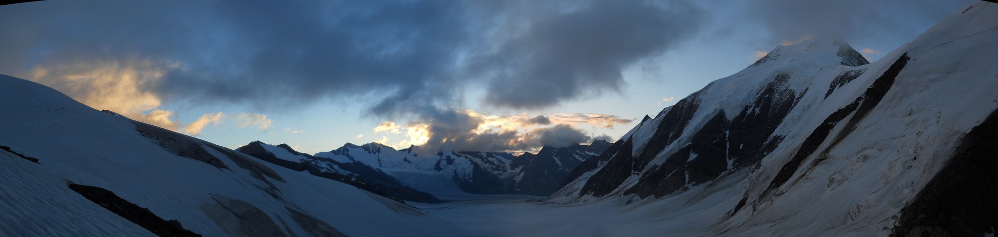
View from the Hollandia Hut (3235m) towards Konkordia Hut
Day 11: to the Konkordia Hut (2850m).
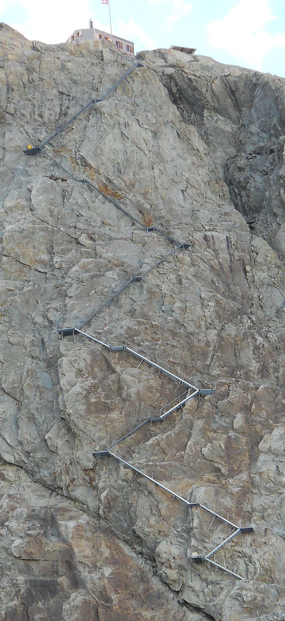
Konkordia Hut staircase
We had intended to climb the Abeni Flue (3962m) but at 3am the snow was still warm and soft from the previous day’s sun and the cloud cover was unappealing. Instead we descended the Grosse Aletschfirn Glacier and the Konkordia Platz. We then took the inconceivable staircase to the Konkordia Hut (2850m).
Distance: 11km – Ascent: 280m – Descent: 630m
GPX Route: www.haroldstreet.org.uk/routes/download/?walk=2992
Accommodation: www.konkordiahuette.ch
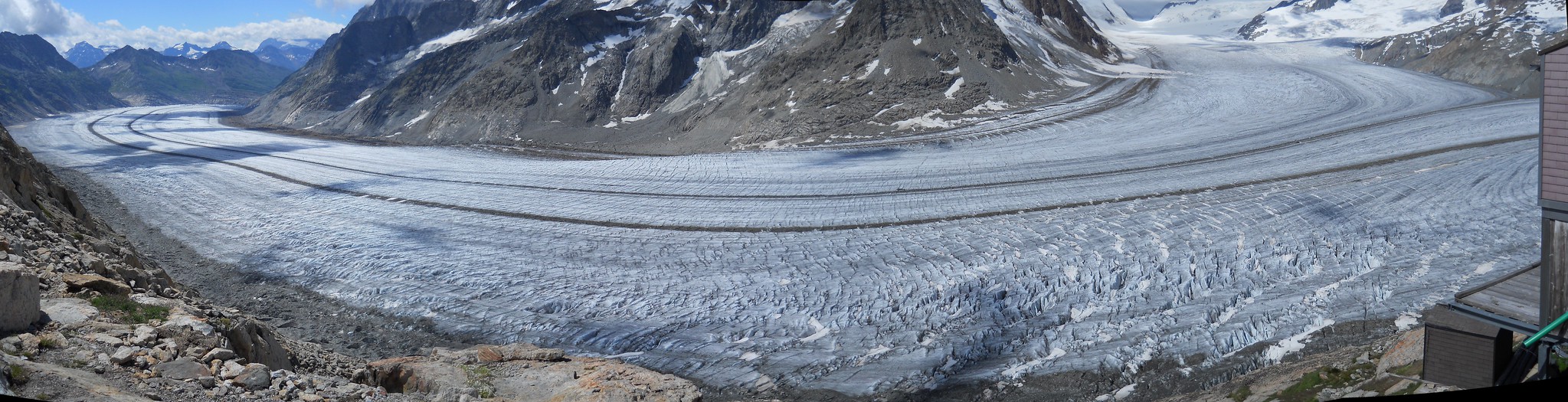
Aletsch Glacier
Day 12: to the Oberaarjoch Hut (3258m).
We crossed the Grunhornlucke (3280m) and the Fischergletcher and then ascended the Galmigletscher and Studergletscher to the Oberaarjoch Hut
Distance: 17.5km – Ascent: 1165m – Descent: 640m
GPX Route: www.haroldstreet.org.uk/routes/download/?walk=2993
Accommodation: www.oberaarjochhuette.ch
Oberaarjoch Hut (3258m).
Days 13 & 14: Weekend in Interlaken
Finally, we descended the Oberaargletscher to the reservoir of the Oberaarsee and caught a bus from the Grimsel Pass
Distance: 15km – Ascent: 180m – Descent: 1220m
GPX Route: www.haroldstreet.org.uk/routes/download/?walk=2994
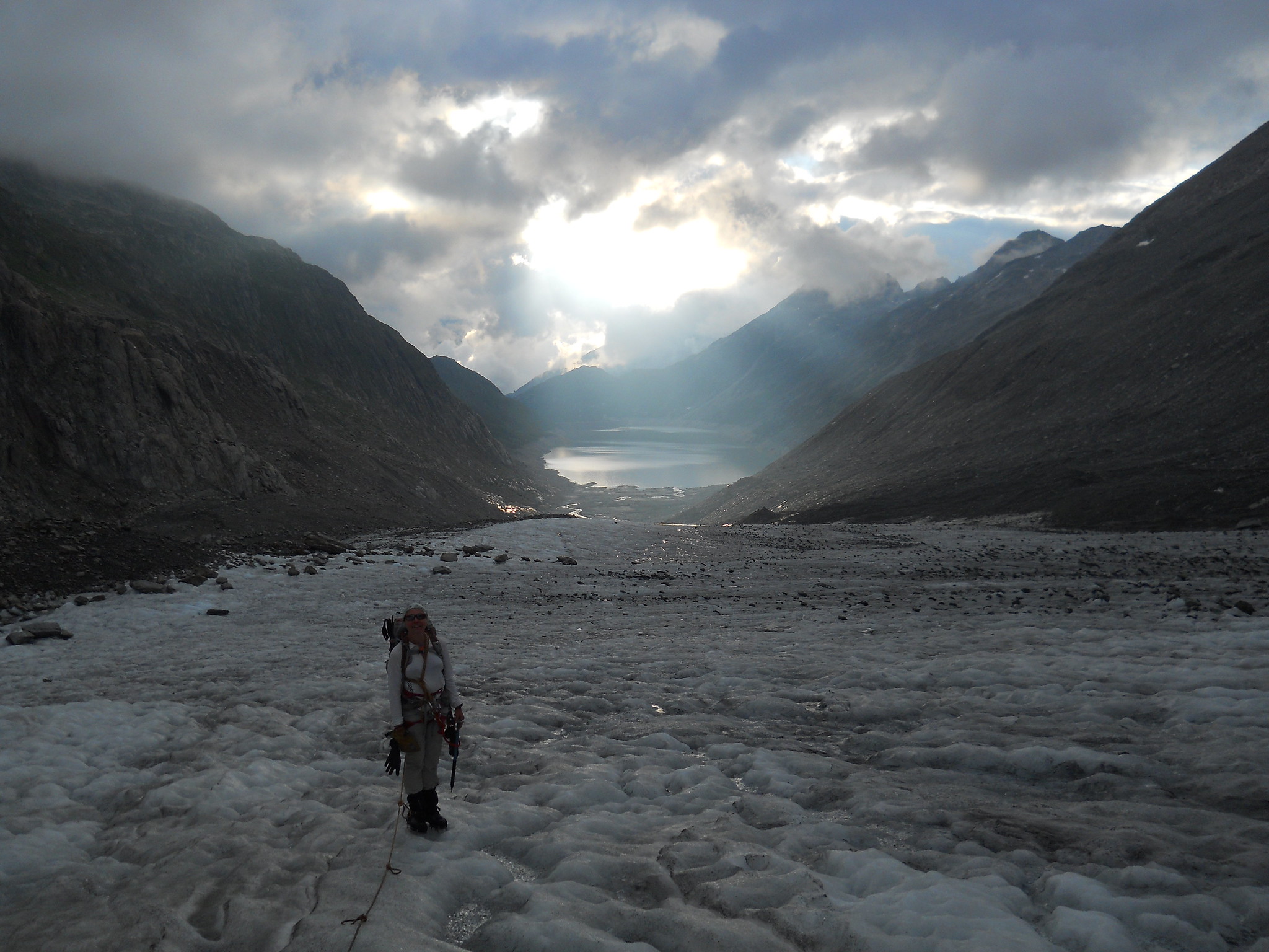
Oberaargletscher
Some Useful Links
- KE Adventure’s Bernese Oberland Haute Route West
- KE Adventure’s Bernese Oberland Haute Route East
- www.summitpost.org/wildhorn/150860
- www.summitpost.org/wildstrubel/151056
Author: Phil Newby

Leave a Reply