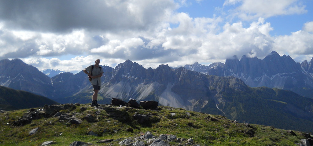
Italian Dolomites 2013 – our alternative AV2
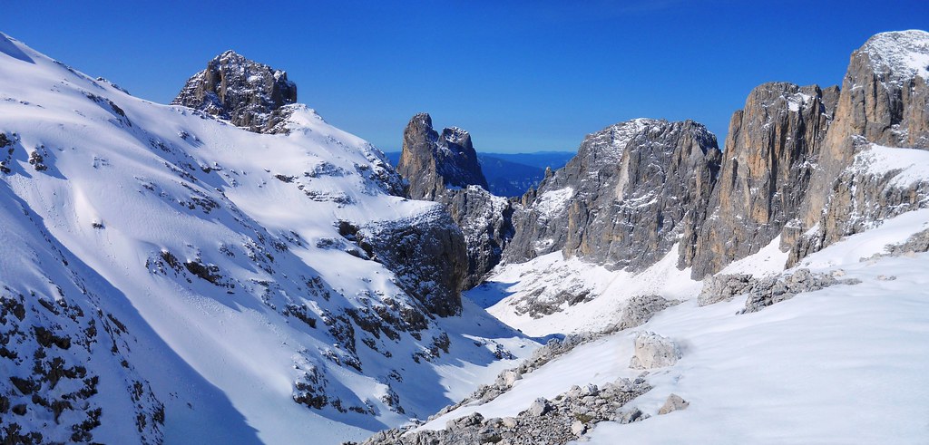
AV2 in Snow
This year we went to the Italian Dolomites to have a go at the “Alta Via 2” also called the “Dolomiten Höhenweg”. We went in the last week of June expecting a considerable amount of old snow from the long cold winter, but to our great surprise we encountered some huge dumps of fresh snow. Consequently we ended up doing many lower level variants to each stage – we called it the “Dolomiten Löwenweg”…
Day 0: To Brixen (aka Bressanone)
We flew to Munich and took the train to Brixen (to spend our first night in a nice cheap and helpful hotel).
Accommodation: Hotel Goldenes Kreuz
Plose
Day 1: Plosehütte (aka Rifugio Città di Bressanone)
We walked up to St Andrea, took the cheap Plose Cable Car and from there walked up to the Plosehütte. This was our easy introductory day and we wandered around on the nearby ridges to acclimatize.
Walking Ascent: 1,000m – Descent: 100mAccommodation: Plosehütte
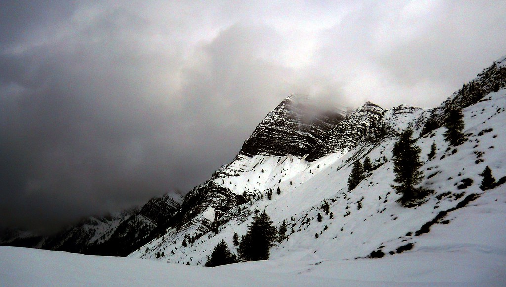
Day 2: Fresh Snow!!!
Our plan was to go to Schlüterhütte (aka Rifugio Genova) however we awoke to a huge dump of new snow like this…
So we sacked it off and retreated back to Brixen.
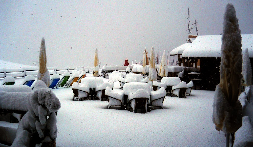
Snow!
Accommodation: Hotel Goldenes Kreuz
Day 3: Passa Gardena
The original plan: Rifugio Puez – the reality: we got a bus round to Selva and walked up to Passa Gardena to get back to the AV2 route.
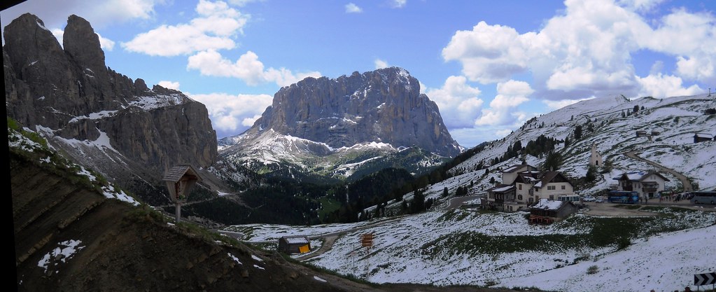
Passa Gardena
Accommodation: Rifugio Frara
Snow
Day 4: Arabba
The original plan: Rifugio Boe – the reality: as Rif. Boe was the highest point on our route and we could see evidence of some recent avalanches we elected to stay low and walk around the Sella Massif on paths: 29, 651, 645, 636 & 657 to Arabba.
Ascent: 935m – Descent: 1,430m – Time: 7 hoursAccommodation: Hotel Genziana
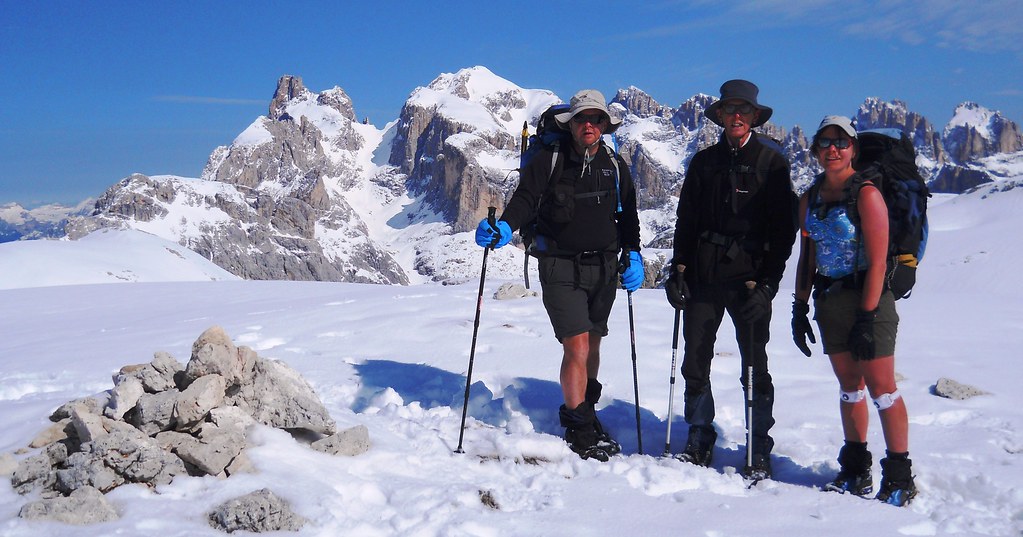
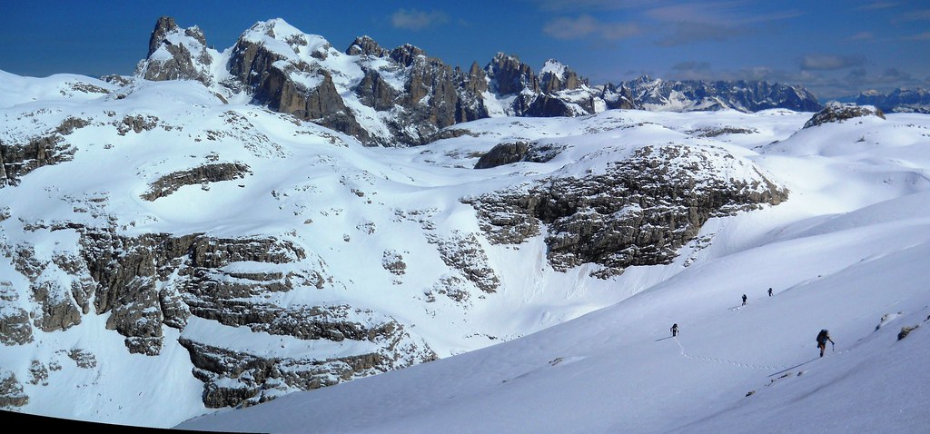
Day 5: Malga Ciapela
The original plan was to go to Malga Ciapela from Rif. Boe, so we made our way there from Arabba to get back on plan as the snow was beginning to melt or at least consolidate. We took a route using paths 698 & 699 over Passo Padon and views of the Marmolada Glacier (which is actually made of ice and not marmalade as you might assume from the name).

Marmolada Glacier
Accommodation: Hotel Tyrolia
Day 6: Passo Valles
Once again our plans were scuppered by a second dump of new snow! The planned stage was long and crossed high cols, we considered the avalanche risk too high and we sacked it off again. We got a lift (from the very help full hotel owners) around to Falcade and walked up to Passo Valles from there.
Passo Valles
Accommodation: Rifugio Capanna
Day 7: Rifugio Rosetta
Guided by the Passo Valles Hotel’s St Bernard Dog, we took a lower level alternative of the AV2 over Forcella Venegia (which showed significant recent avalanche activity). We continued on lower routes and finally took the Col Verde Cable Car to get up to Rif. Rosetta.

Forcella Venegia
Accommodation: Rifugio Rosetta
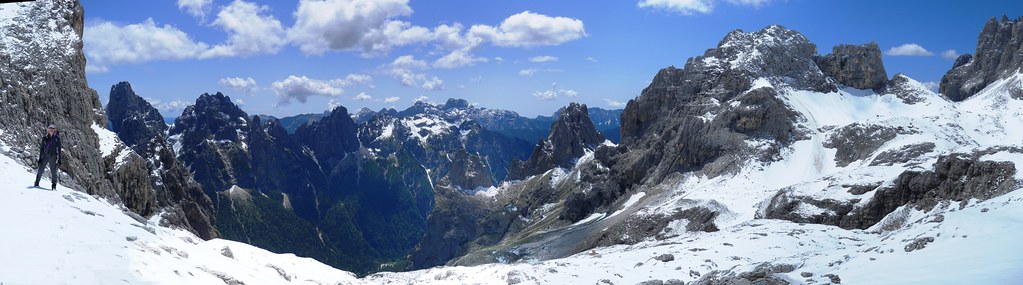
Day 8: Rifugio Treviso
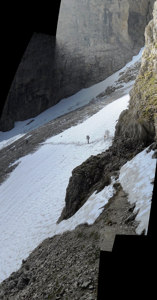
Whilst continuing on the AV2 was still out of the question, the Guardians had helpfully marked out the easier route (708) over Passo di Pradidali across gentler terrain towards the small Fradusta Glacier. As this was a short-cut we thought we would risk it. At the Passo Fradusta however we realised the path had been marked out only for the guided groups climbing on the glacier, and our route to Passo delle Lede was still deeply buried under fresh snow.
Passo Fradusta
Even so, the distance to the col was only 1km and so we kicked and cut steps through the deep and partially frozen snow.
About halfway across our NW facing slope steepened significantly, and my avalanche assessment pits indicated that under the 2 inches of hard icy snow (from Thursday), was around 9 inches of soft powdery dry snow (from Sunday), on a thin layer of loose hailstones, resting on a basement of old hard snow-ice beneath. This was all very poorly bonded and at considerable risk of falling off and taking us with it.
Crossing dodgy slopes
To mitigate this risk we crossed the open sections of the steep slopes one at a time, partly so we never had more than one person’s weight on a slope at a time, and partly so the rest of us could help if there had been a slip. This was all a bit nerve racking – and not at all helped by the very loud crack of an avalanche occurring just across on the opposite sunny side of the valley.
Towards Passo della Lede (top left)
With some relief we arrived at the Lede col and descended into the top of the Vallon delle Lede corrie. The snow here faced south directly into the sun, and so it was horribly soft and loose despite it still being quite early in the day. We picked our way carefully down the slope. Just then, an avalanche of several hundred tons of snow and rocks came from high above us, missing me by around 20m or so. We carried on as there was no other choice but with significantly elevated stress levels.
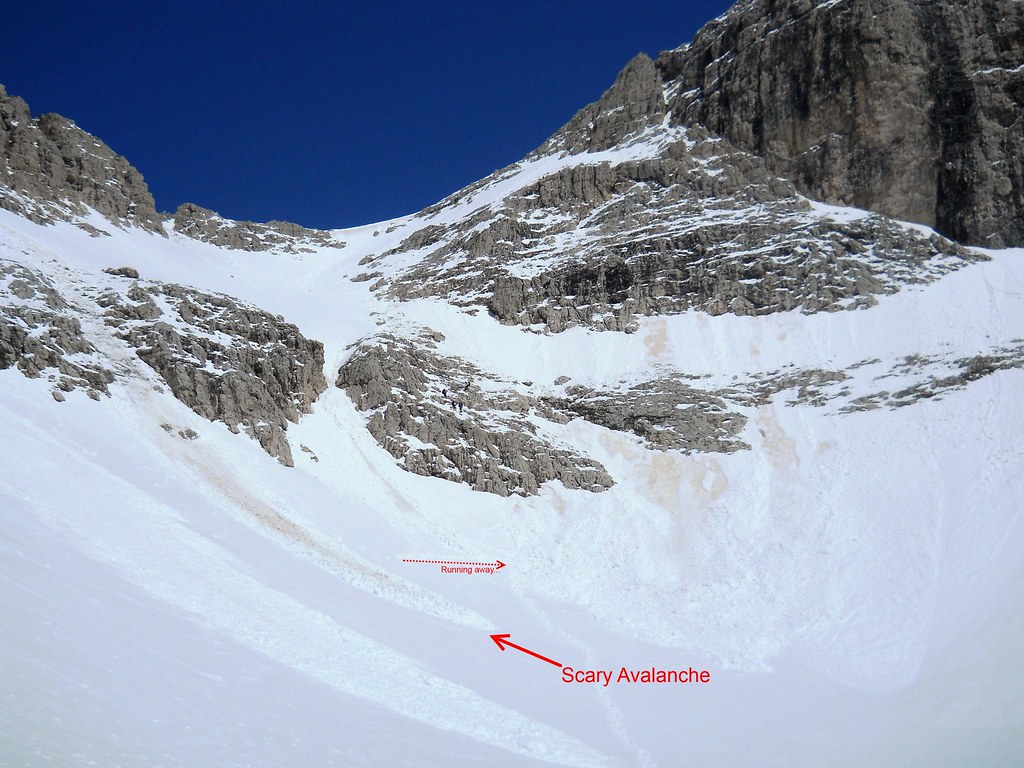
Avalanche
The descent of the Vallon delle Lede valley was slow and hard going, but once we reached the Bivacco Minazio where we left the dodgy snow behind, we could relax and have lunch.
Vallon delle Lede
It was an “interesting” day. In hindsight we made those little errors of taking small incremental risks because we didn’t want to turn back, but not considering that there would be worse to come – and those risks rapidly ratchet up.
However the really big mistake was actually made the night before we even set off, when we failed to ask the Guardian about the route! – even so we got the best photos this day.
Accommodation: Rifugio Treviso
Day 9: Passo Cereda
The AV2 route to Passo Cereda was relatively low from here, so for the first time for the entire trip we completed a section as planned (despite the temporary misplacement of a Passport).
Karst Limestone
Accommodation: Rifugio Albergo
Day 10: Rifugio Boz
The guardian/guide at Rif. Treviso warned us that the AV2 route over Passo del Comedon was unsafe and should be avoided. So we took a taxi round to Fiera di Primiero (to drop off Richard) and then to Rif. Fonteghi. From there we took path 748 up to Rif. Boz – a really beautiful day in its own right.

Beer
Accommodation: Rifugio Boz
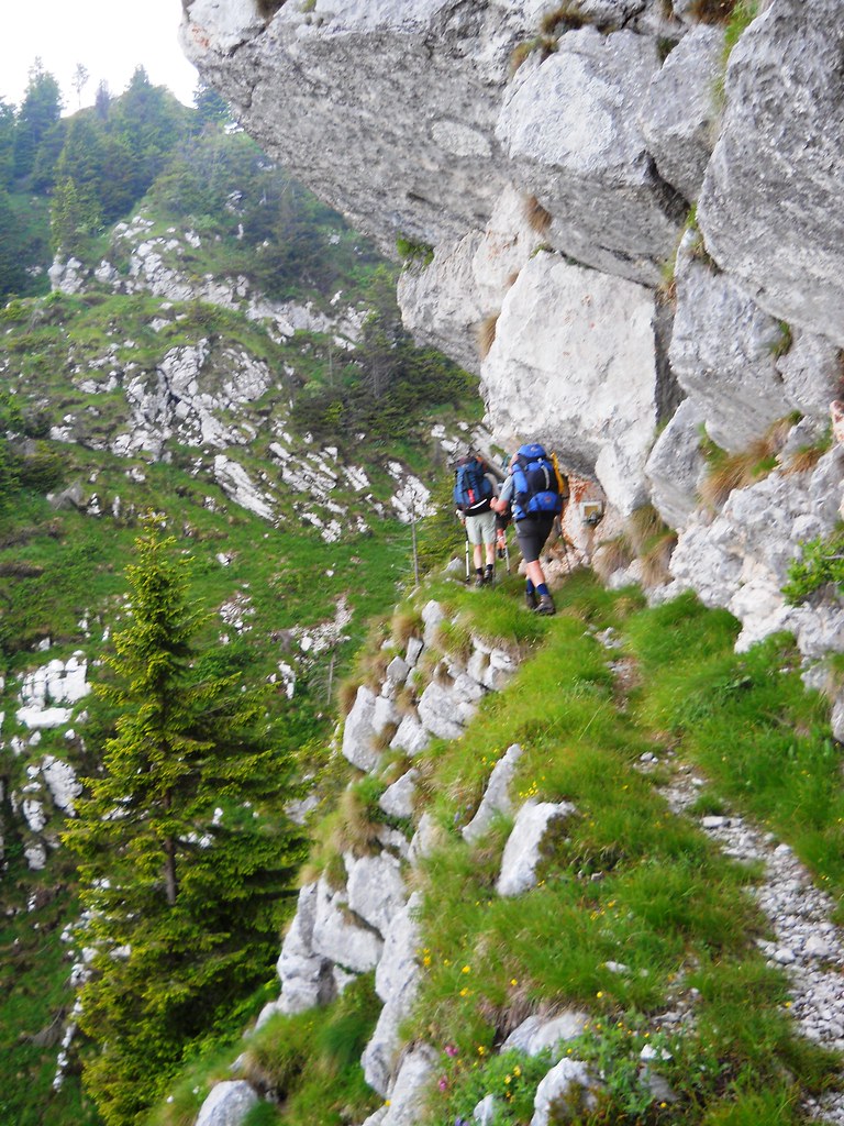
Exposed Route
Day 11: Back to Brixen
The plan was to finish our AV2 route to Rifugio Dal Piaz, however after crossing Passo di Finestra in damp ominous fog we all decided it was not quite right and sacked it off. Later, we felt vindicated with our decision when we descended to be caught in heavy thundery showers. We walked down to Fiera di Primiero and got buses & trains back to Brixen.
Ascent: 495m – Descent: 1,460m – 6.5 hoursAccommodation: Hotel Goldenes Kreuz
Day 12: Exploring Brixen
We had a well earned nice restful day exploring Brixen, with only food and beer to challenge us.
Ascent: 255 – Descent: 255mDay 13: Revisiting Plose
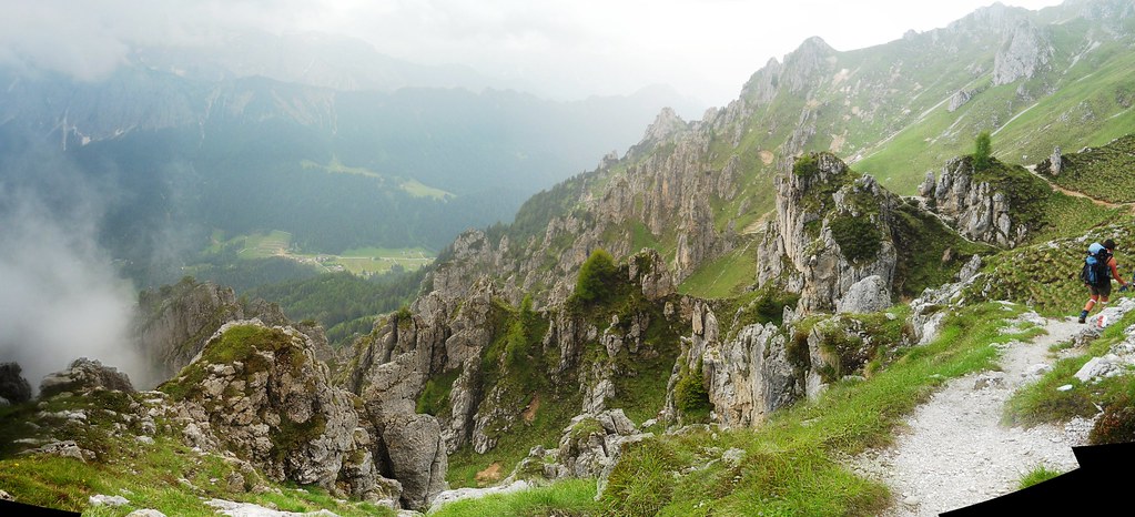
We took a bus & the cable car back to Plose to check out what we missed on day two of our trip – we followed the ridge route (7) to the Gabler and came down to Palmschoss to get the bus back. Their bus services are fantastic and very cheap!
Plose
Day 14: Schlüterhütte (aka Rifugio Genova)
Again, we wanted to see what we’d missed out on earlier, and so we got a bus round to the car park below Forcella de Putia and took the AV2 route over it to the Schlüterhütte. From there we took routes 3, 6, 35 and 33 down to Rif. Zannes to catch a bus back.

Schlüterhütte
Total Trip Ascent: 10.1km – Total Trip Descent: 12.0km
Some More Information…
- These are the maps we used: Tabacco 030, 07, 015,022, 023 all at 1:25k (see ads below).
- We also had a copy of Gillian Price’s Trekking in the Dolomites (Cicerone Mountain Walking)
Author: Phil Newby
Leave a Reply