Glacier Fest: Swiss Alpine Trip – June 2015

Week 1: Glacier Haute Route
For our first week we did part of the Glacier Haute Route from Arolla to Zermatt (we had previously done the bit from Chamonix in 2005 – details here)

New Pas de Chevre Ladders
Day 1: Arolla to Cabane des Dix (2,928m):
We flew out to Geneva, got the train to Sion and then a bus up to Arolla for the lovely walk up to the Pas de Chèvres ladders (now much improved since our last visit). A short loose scree descent onto the dry glacier and up to the fantastic Dix hut.
Distance: 13km – Duration: 4.5hrs – Ascent: 1050m – Descent: 150m
Accommodation: www.cabanedesdix.ch (for 3 nights)
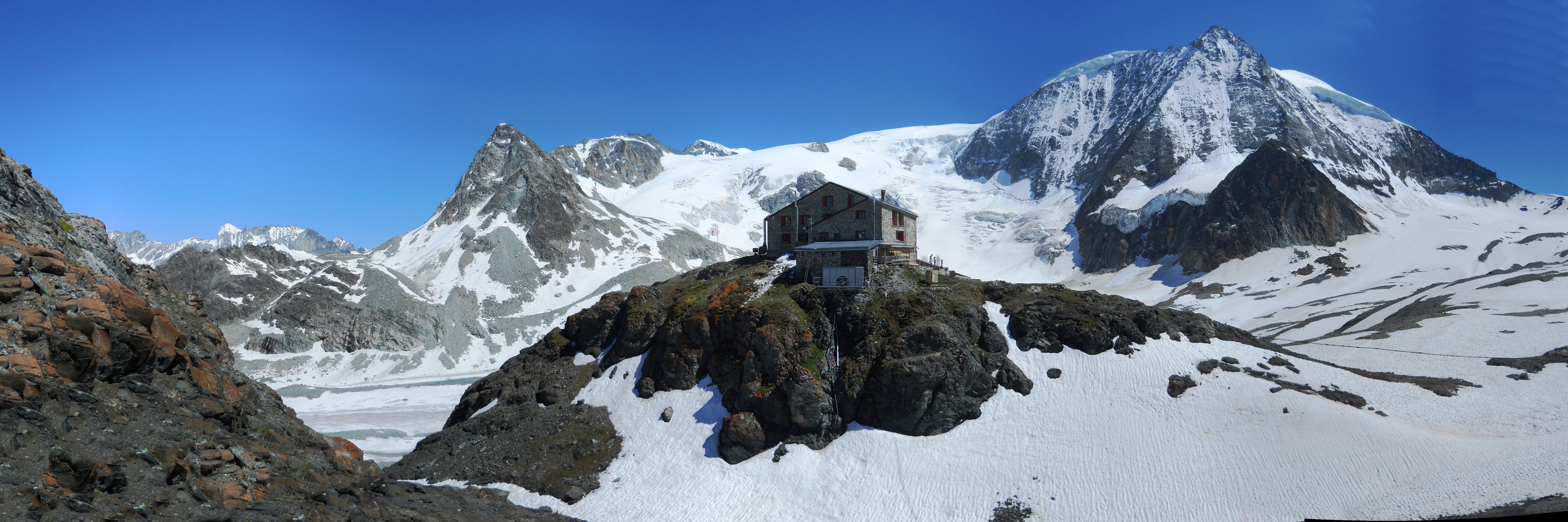
Cabane des Dix with Mont Blanc de Cheilon behind

La Luette Summit Ridge
Day 2: Acclimatisation & Glacier Practice day:
We spent our first day acclimatising by walking over the glaciated Col de Cheilon (3237m) to Col du Mont Rouge (3325m) and back. We also did some skills practice: belaying and abseiling en route.
Distance: 12km – Duration: 4hrs – Ascent: 500m – Descent: 500m
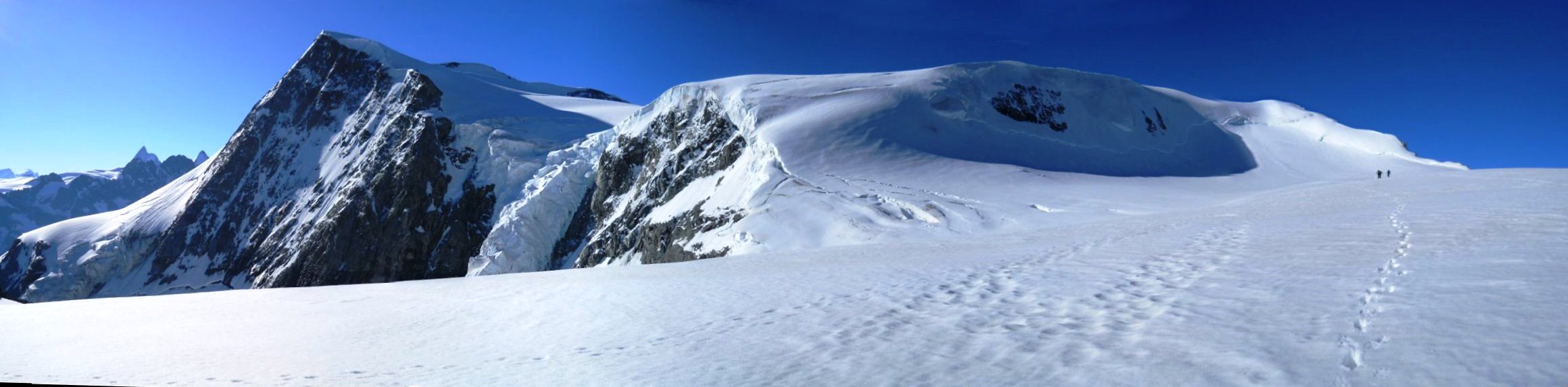
Day 3: La Luette (3,548m):
We got an early start to climb the easy La Luette peak from the Dix hut for further acclimatisation and glacier skills refreshment.
Here is a map & gpx file of the route we took…
Distance: 6km – Duration: 4hrs – Ascent: 600m – Descent: 600m
Pigne d’Arolla Summit (on left) after the very steep bit (centre)
Day 4: Cabane Des Vignettes (3,157m) via Pigne d’Arolla (3,796m):
Due to the unseasonal heatwave, we chose to get a 4.00am breakfast for an early start on our first proper stage of the Haute Route. Taking turns with Étienne the Guide, we kicked steps up the steep soft glacier. The ascent of Pigne d’Arolla was fantastic and the views spectacular.
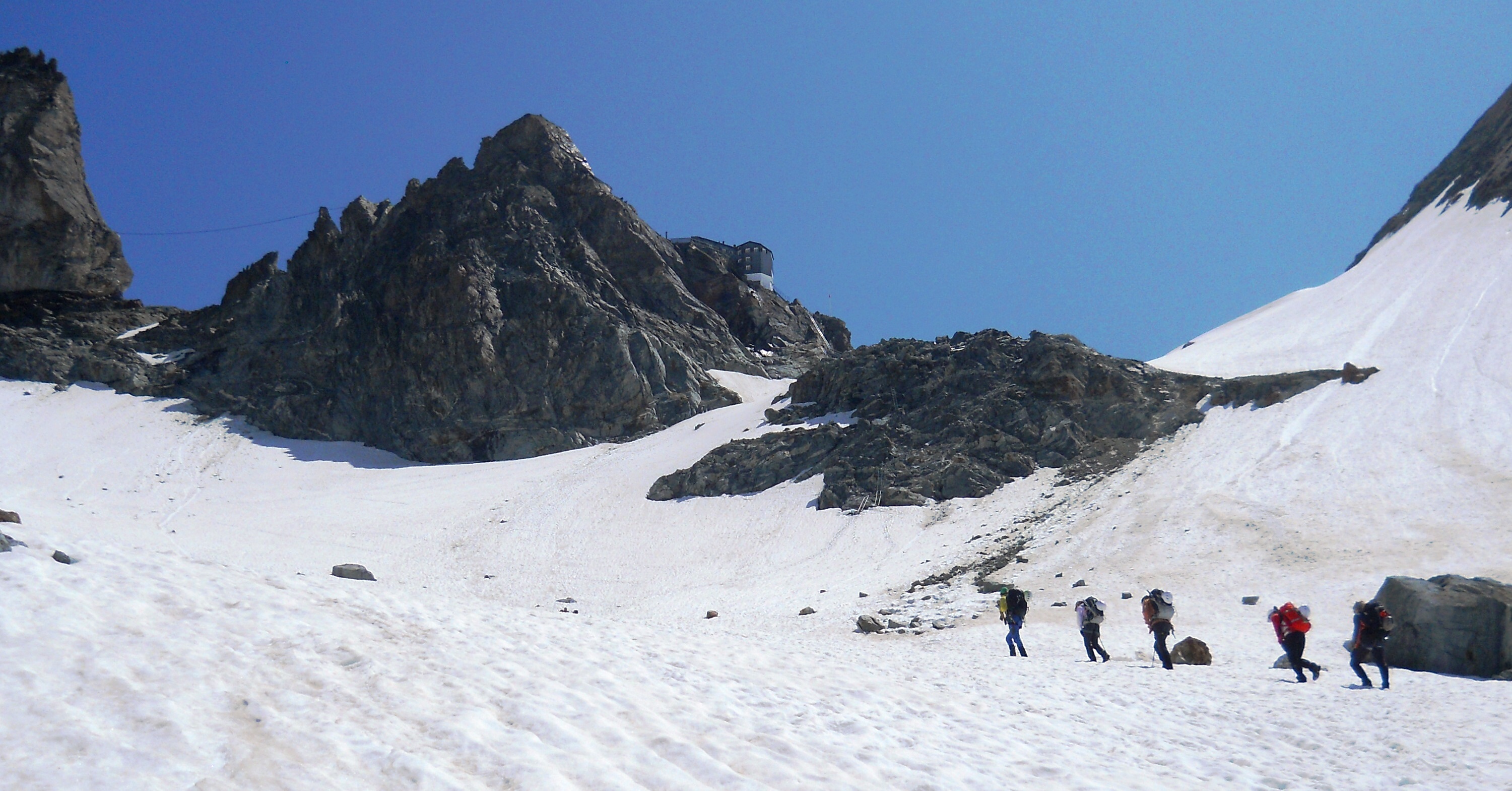
The improbable Vignettes hut perches precariously off the side of a cliff and is accessed by an airy snow ridge.
Here is a map & gpx file of the route we took…
Duration: 6.5hrs – Ascent: 970m – Descent: 760m
Accommodation: www.cabanedesvignettes.ch

Vignettes Hut ridge
Day 5: Cabane Bertol (3,311m) via Col de l’Évêque (3386m):
A beautiful but long day briefly crossing the Italian border twice on glaciers as we went over the Col de l’Évêque and down the Arolla Glacier.
The Bertol Hut proved to be even more improbable than the last, teetering high upon a sharp rock arrêté requiring a multi-laddered ascent.
Here is a map & gpx file of the route we took…
Distance: 18km – Duration: 8hrs – Ascent: 1,170m – Descent: 1,000m
Accommodation: www.bertol.ch
Cabane Bertol above the col
Day 6: Schönbiel-hütte (2,694m) via Tête Blanche (3,710m):
Descending the Bertol ladders in the dark for another early start, we crossed the Glacier du Mont Mine and climbed up to the Tete Blanche summit with stunning views of the Matterhorn, Dent d’Herens and Dent Blanche.
The descent of the Stockjigletscher glacier was straightforward due to lots of snow covering the crevasses. Getting off the moraine at the base of the Stockji proved a little tricky due to the snow, requiring a short abseil.
The final signed route to the Schonbiel Hut was a terrible mess of loose scree, boulders and piss-poor waymarking – we’d suggest you don’t follow the new signed path (North) across the dry Schonbiel glacier, but continue down the Zmutt valley (East) towards Zermatt for a bit and ascend the nice stable path up the moraine from there.
Here is a map & gpx file of the route we took…
Distance: 16km – Duration: 8hrs – Ascent: 775m – Descent: 1,365m
Accommodation: www.schoenbielhuette.ch

Tete Blanche Summit with Matterhorn & Dent d’Herens
Day 7: Zermatt:
Our glacier Haute Route was completed by a half-day stroll down easy paths into the hustle and bustle of Zermatt. Here we based ourselves for 3 nights in a self-catering apartment and used the services of a local launderette and the supermarkets to great effect.
Distance: 13km – Duration: 4hrs – Ascent: 65m – Descent: 840m
Accommodation: Viscaria Apartment (for 3 nights)
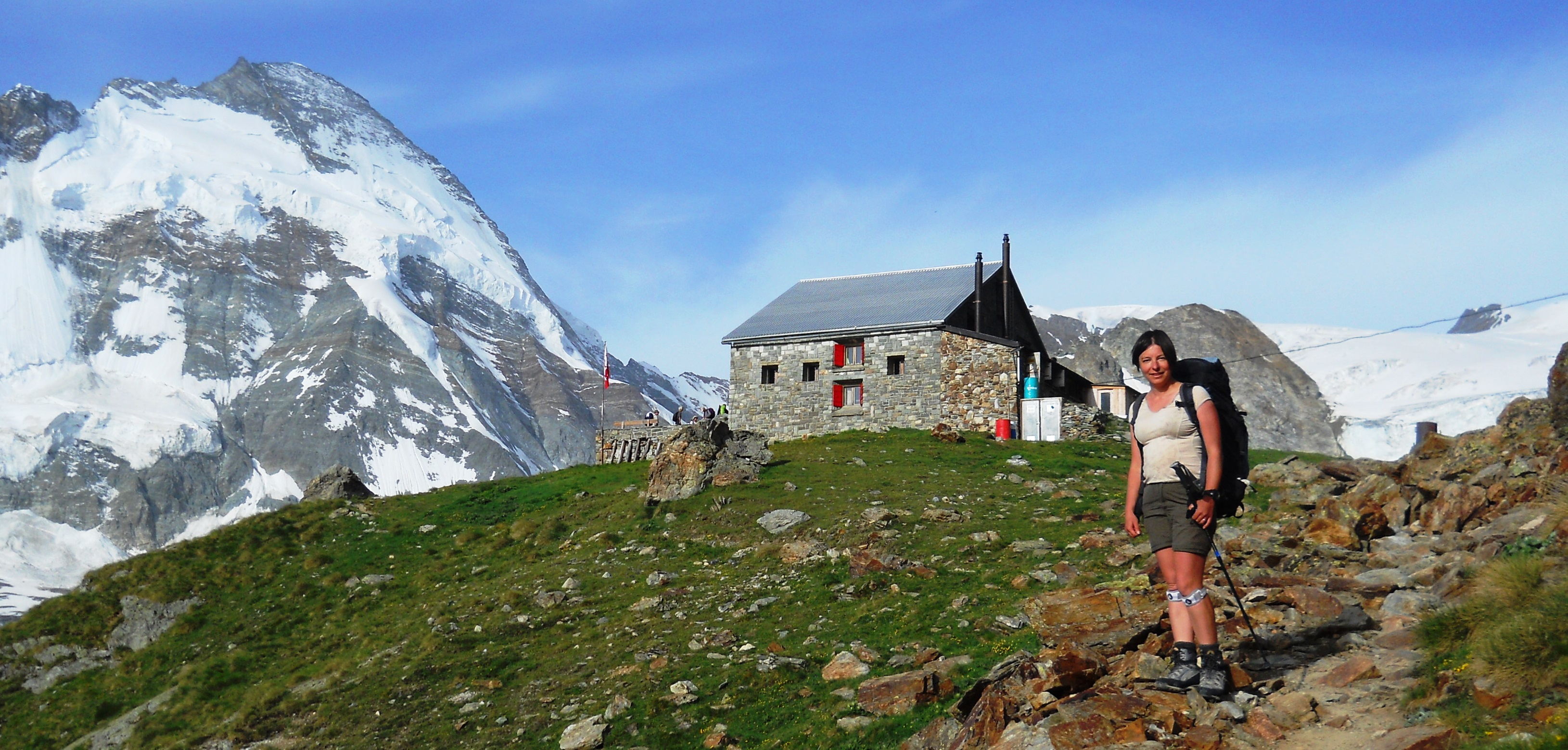
Schonbiel Hut with Tete Blanche behind (to the right)
Week 2: Some Peak Bagging
Ober-rothorn Summit + random wanky art installation
Day 8: Ober-rothorn (3,414 m):
We bought a two day lift pass and ascended the Sunnegga/Rothorn lift to Unter-rothorn. From there we had a nice half rest day climbing the Oberrothorn for fantastic views of the 38 local 4000+m peaks.
Duration: 3hrs – Ascent: 550m – Descent: 550m

Breithorn Summit Ridge
Day 9: Breithorn (4,164m):
An early start for the first lift up Trockner Steg to the Klein Matterhorn lift station to revisit the easiest of the 4000m peaks: the Breithorn. We also spent an hour or so watching the film shows in the highest cinema too for a bit of additional acclimatisation.
Here is a map & gpx file of the route we took…
Distance: 6km – Duration: 3hrs – Ascent: 410m – Descent: 410m
Day 10: Rest day and transfer to Zinal:
An actual rest day: We hopped on a train to Sierre, and then caught the bus back up to Zinal and didn’t walk anywhere at all – nice!
Accommodation: Hotel le Trift
Cabane du Grand Mountet
Day 11: Cabane du Grand Mountet (2,886m):
From Zinal we walked up to the Grand Mountet Hut. A surprisingly tough ascent over quite a distance, but lots of pretty flowers along the way.
Duration: 8hrs – Ascent: 1,260m – Descent: 255m
Accommodation: www.cas-diablerets.ch/mountet.htm
Trifthorn (left) & Ober Gabelhorn (right)
Day 12: Cabane du Petit Mountet (2,142m) via Trifthorn (3728 m):
We took another 4.00am start to ascend the Trifthorn. The bergschrund crevasse at 3500m was however too wide and too steep for our liking, so we sacked it off – even so the views were terrific. On our return to the Hut for second breakfast we met a visiting helicopter dropping off supplies and then we continued down to the Petit Mountet Hut.
Here is a map & gpx file of the route we took…
Distance: 18km – Duration: 9hrs – Ascent: 1,030m – Descent: 1,715m
Accommodation: www.petitmountet.ch

Cabane du Petit Mountet with Weisshorn behind
Day 13: Cabane Tracuit (3,256m):
From the Petit Mountet we crossed the valley and ascended the far side, passing the “Roc de la Vache” and up to the Tracuit Hut. The hut has been completely rebuilt since our last visit, and is a lovely modern building (shame it still has only 4 toilets for over 100 people).
Distance: 11km – Duration: 5hrs – Ascent: 1,529m – Descent: 330m
Accommodation: www.tracuit.ch
The New Cabane Tracuit
Day 13: Bishorn (4,153 m):
Doing the Bishorn on a weekend should generally be avoided as it is VERY popular. However we couldn’t avoid it, so instead we got up a bit earlier than everyone else, and were a bit more efficient in getting ready so we were one of the first groups out straight after breakfast.
The ascent is an easy snow plod avoiding some significant crevasses, the only minor difficulty is the last 50m or so on an exposed icy ridge to the summit.
We then had second breakfast in the hut before the long descent back to Zinal.
Here is a map & gpx file of the route we took…
Distance: 18km – Duration: 4hrs for Bishorn, & 4 hours back to Zinal – Ascent: 950m – Descent: 2500m
Accommodation: back to the Hotel le Trift again
Steep icy ridge to Bishorn summit
The Weisshorn viewed from the Bishorn Summit
Day 14: Returned Home
Bus to Sierre & train back to Geneva airport…
Some Useful Links
- Glacier Haute Route: www.wikipedia.org/Haute_Route
- Pigne d’Arolla: www.summitpost.org/pigne-d-arolla
- Tete Blanche: www.wikipedia.org/Tete_Blanche
- Breithorn: www.summitpost.org/breithorn
- Trifthorn: www.summitpost.org/trifthorn
- Bishorn: www.summitpost.org/bishorn
Author: Phil Newby
Leave a Reply